Home | Gallery | AboutUs | Software | Rates ![]()
![]()
![]()
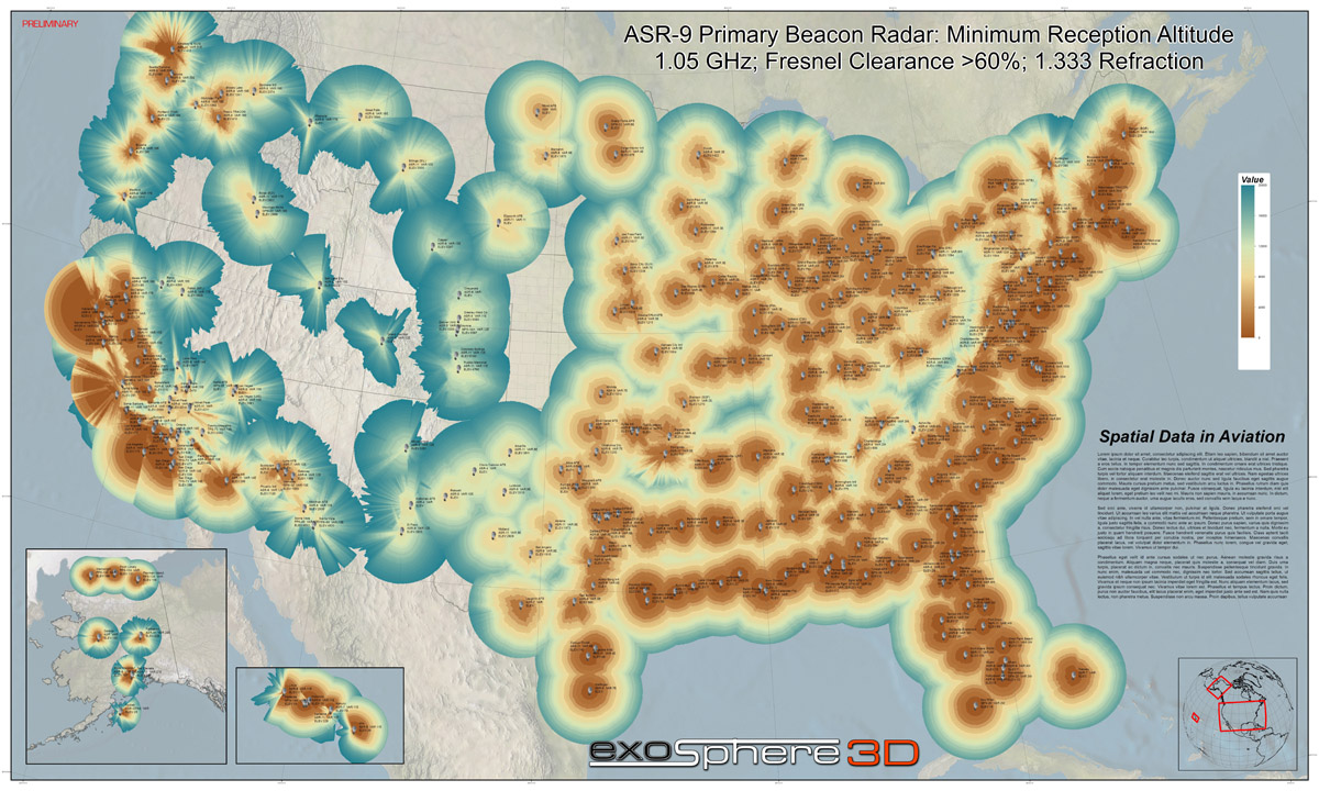
We are in the middle of a huge aviation mapping project. We are creating viewshed maps (radar coverage maps) of the entire USA for all ASR and ARF sites (short and long range aviation radar facilities), all NEXRAD radar facilities, all surface weather observation sites and ground based radio aids to navigation.
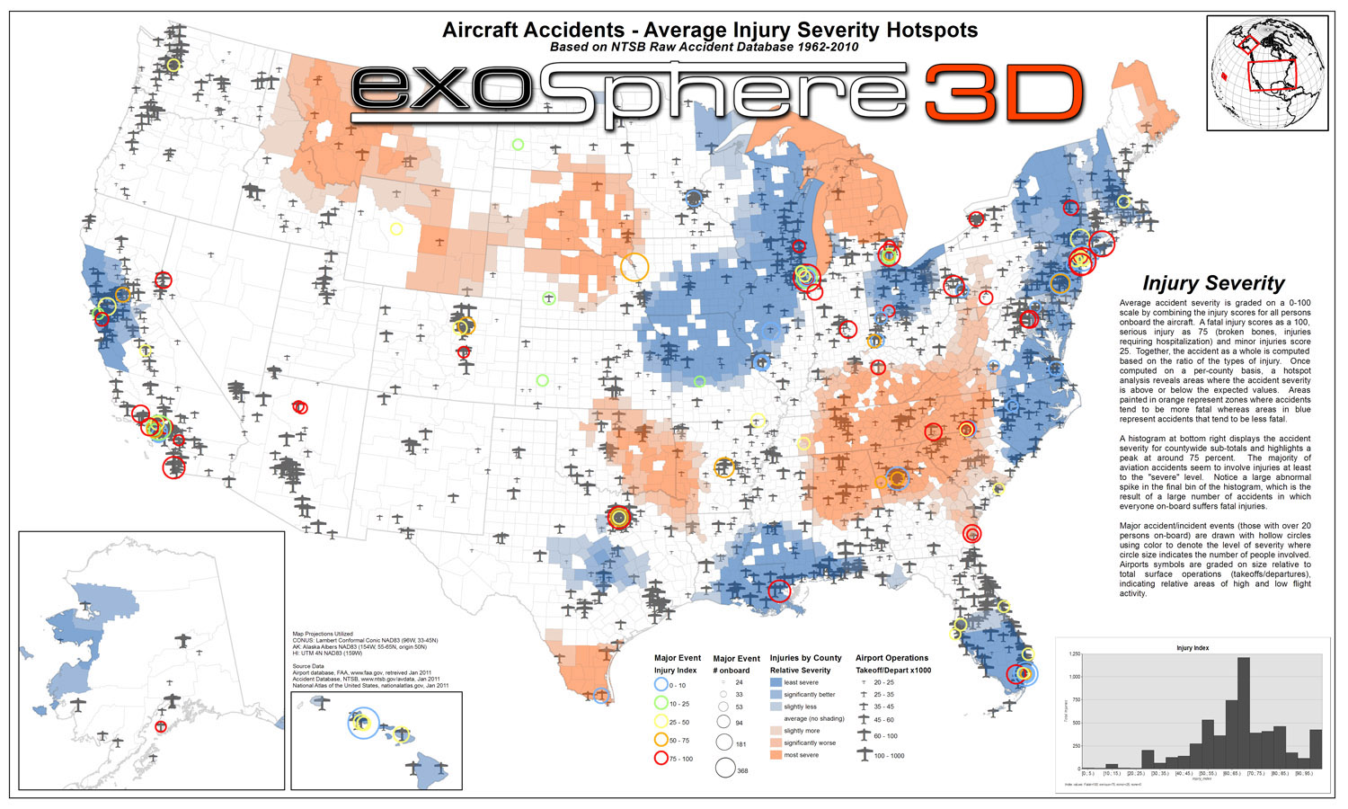
In addition, we have geocoded the entire FAA airman registry and accident database. We are conducting statistical analysis of the data including a variety of underlying data layers including population data and more. The end result of this project will be a comprehensive web-based GIS data service that anyone can access and explore. Users will be able to examine actual minimum reception altitudes and patterns in crashes and injuries.
We presented this topic at GIS in the Rockies August 31, 2011 and also at the GIS Colorado Fall 2011 meeting on October 7th, 2011. If you are interested in any of the materials from these presentations, please send us an email. You may be particularly interested in our "GeoServer Cookbook", which is essentially our operational notes on how to create an Ubuntu EC2 machine using Amazon Web Services and subsequently load data onto the machine using PostGIS/PostgreSQL. Data is served using GeoServer and queried using OpenLayers. We will soon be posting tutorial materials to this webpage to assist you in creating your own web mapping application.
Applied GIS for Mapping Aviation Infrastructure and Statistics
The purpose of this project is to deliver aviation-specific information as a WMS (web map service), pre-packaged digital map products, or printed posters. The contiguous USA, AK and HI are covered. Pilots, air traffic controllers, and anyone with curiosity towards aviation will find the information insightful. This effort is novel due to the varied nature of datasets explored and analyzed. A variety of powerful GIS tools and techniques made this possible. We have geocoded 1.2 million addresses of aircraft owners, pilots, mechanics and other airmen. We processed 80 thousand individual viewshed slices to create a comprehensive radar coverage map for NEXRAD weather facilities and ground-based aircraft radar. Approximately 150 thousand aviation accident database records since 1962 are categorized and mapped. Through spatial analysis, we are exploring and presenting patterns that relate injury severity to location, terrain, proximity to airports and more. Continuing efforts will integrate ground clutter models for refined viewshed analysis and will combine multiple public domain data sources into the WMS. Some discussion of Cloud-based computing will be included to orient the audience with techniques necessary to distribute massive datasets efficiently.
Copyright 2011 Exosphere3D.com