Home | Gallery | AboutUs | Software | Rates ![]()
![]()
![]()
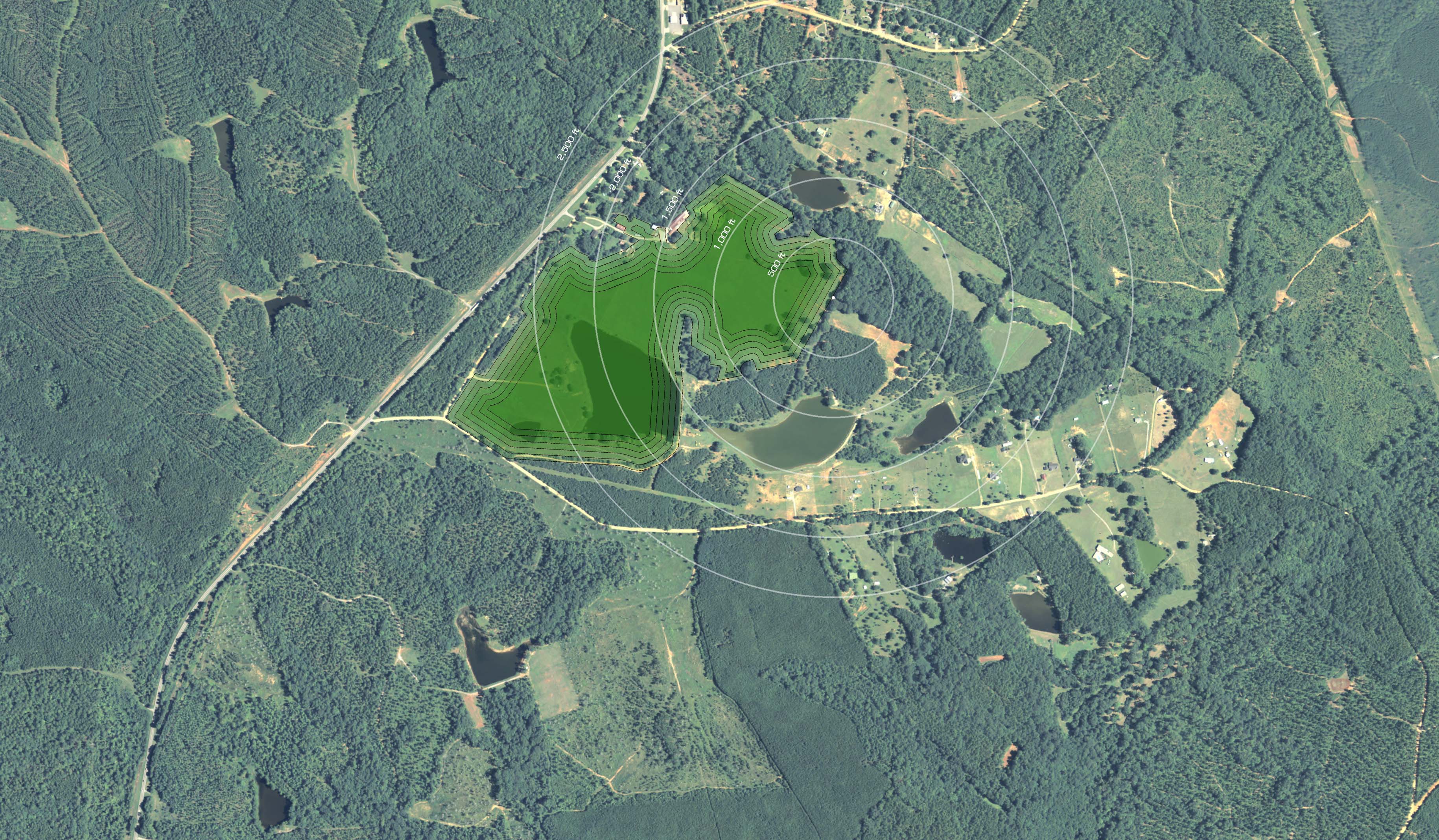
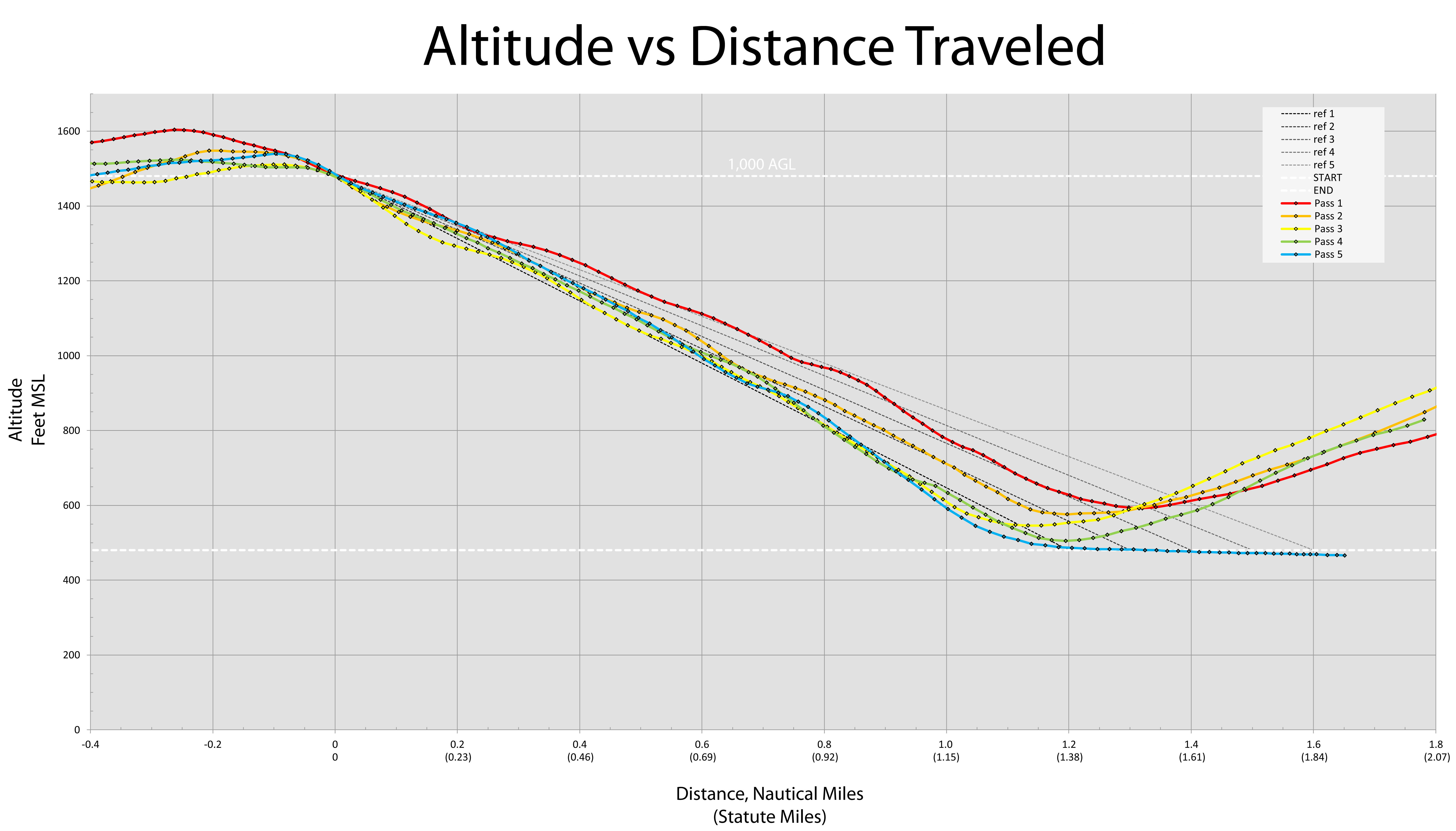
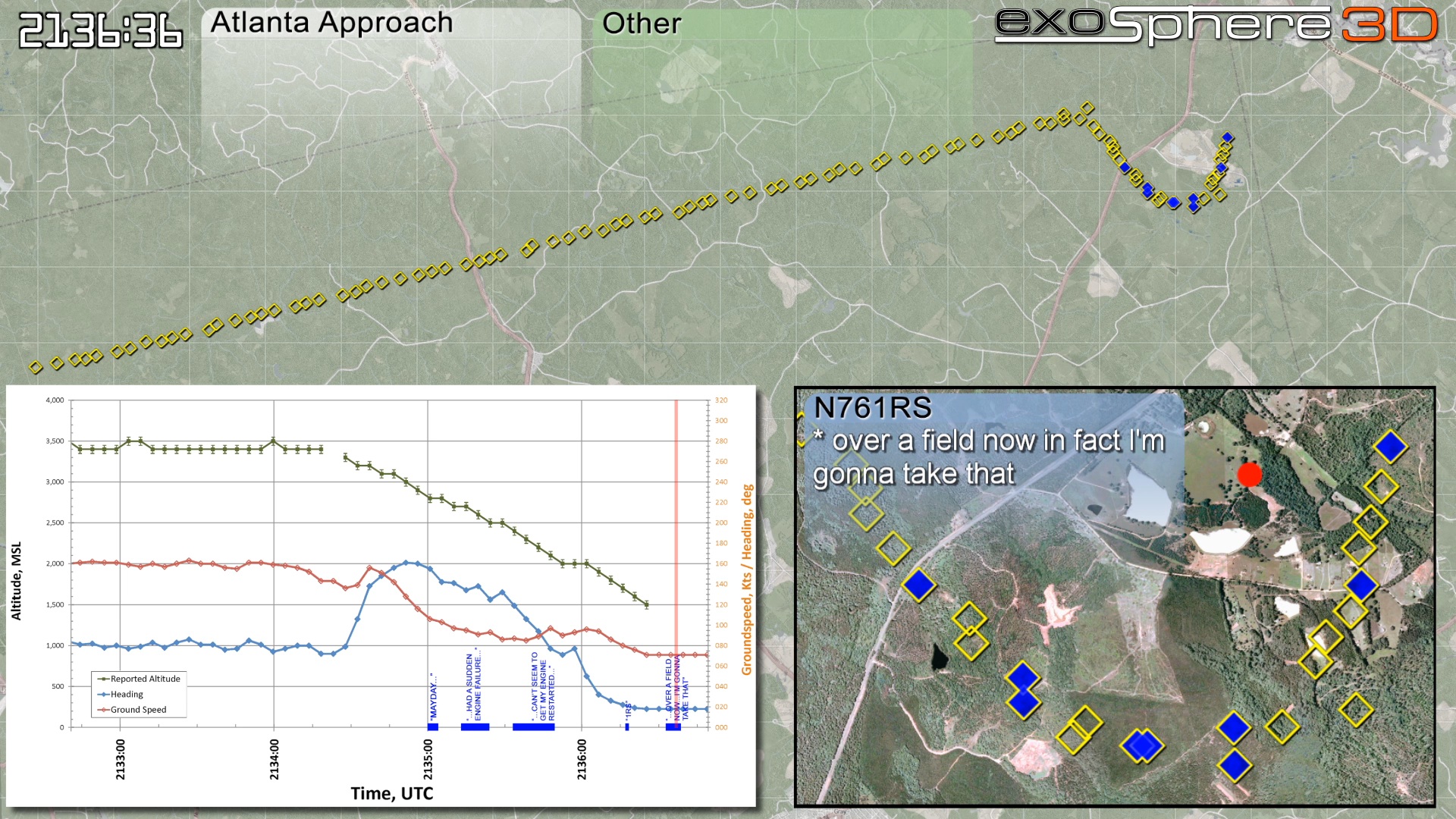
Exosphere3D was retained in the reconstruction of an accident timeline for this particular crash involving a Cessna 210 in Georgia. The accident aircraft, N761RS, was in cruise flight when the engine suddenly stopped. Audio recordings from air traffic control captured the pilot's radio transmissions during this event. Radar data was only available in a screen capture format provided by the FAA. We accurately georeferenced these screen playback images, allowing us to accurately depict the flightpath in relation to ground features and the crash site. Basemaps were created from geospatial data such as satellite imagery and vector street maps. A scrolling graph depicts the altitude, ground track, and ground speed of the aircraft as reported in the radar dataset. Mr. Osterbuhr provided deposition and courtroom testimony to substantiate the work. The case was tried in 2011 in Lawrenceville, GA.
If you wish to explore some of the data associated with this accident, download the Google Earth KMZ file we have prepared here. The file includes the accident aircraft radar data, related flight test data, and other pertinent information used in analyzing the accident. The NTSB's full narrative is located here.
Click here for a full resolution screen capture of the animation. The complete reconstruction video is available on our YouTube channel here.

Copyright 2011 Exosphere3D.com